Import from a location table
Minimal import
To implement a survey list, you must at least prepare a csv or xlsx table with :
- survey name ;
- X and Y coordinates ;
- the EPSG code of the Reference Coordinate System (RCS) of these X and Y coordinates.
The rest is optional.
To know
In reality you can even do without the contact details columns and just specify a list of names, and declare the contact details individually later, but then the point of the import is limited.
The only technical point at this stage is to be able to fill in the column specifying the SCR for each survey.
If your X and Y are longitudes and latitudes, then all you need to do in this column is enter "4326", which is the EPSG code for the WGS84 system.
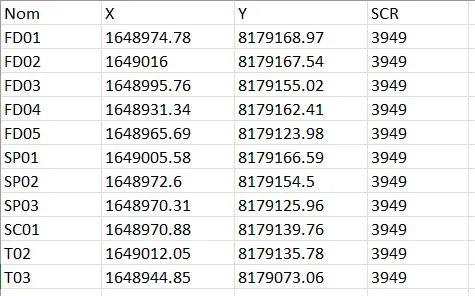
Here's an example of a minimal table with coordinates in the "Lambert 93 / CC49" system, whose EPSG code is "3949":
Finding the EPSG code of a system is easy via the Orbow survey creation window, or via epsg.io.
The SCR can be different for each line. Orbow recalculates the longitude and latitude of each sounding from the coordinates indicated.
Point of attention
The main problem when importing Excel files is the presence of empty lines / with formulas / with formatting, which can in some cases cause problems. In the event of a problem, check that the lines beyond the last data line are empty and without formulas.
Orbow-specific value lists
The LOCA table contains the standard AGS columns and additional Orbow-specific columns for specifying a number of general information points relating to these surveys.
Many of the columns taken from the AGS are not used operationally by Orbow, or are calculated / filled in automatically by the application itself. They have nevertheless been retained in the application and are visible for two reasons:
- to ensure total compatibility with AGS in import and export: these columns can therefore receive data according to your needs and uses;
- to be able to view the data for all data that may be present and imported from an AGS file.
Columns specific to Orbow are of the form loca_orb_xxxx.
The following table lists all columns and their contents.
For lists ("Enum"), the list of possible values and their meaning is specified in the following paragraph.
As this is a tutorial dedicated to importing tables, we have specified in the "To be used?" column which columns are useful for this type of import in Orbow (✔️) and which are not (⛔).
| Column name | Type | To use ? | Page | Content |
|---|---|---|---|---|
| loca_id | Text | ✔️ | Identity | Survey name |
| loca_orb_gtype | Enum | ⛔ | Reference type: currently only LOCA_GTYPE_BOREHOLE is available and functional. This field is automatically filled if empty. | |
| loca_type | Text | ⛔ | Survey type from AGS, different from Orbow loca_orb_type, but automatically filled with Orbow if the type exists in AGS | |
| loca_stat | Text | ⛔ | AGS status, different from Orbow status | |
| loca_nate | Num | ⛔ | National X coordinate, AGS field not used by Orbow | |
| loca_natn | Num | ⛔ | National Y coordinate, field AGS not used by Orbow | |
| loca_gref | Text | ⛔ | National datum, field AGS not used by Orbow | |
| loca_gl | Num | ⛔ | TN level not used by Orbow. Head of the survey is loca_locz | |
| loca_rem | Text | ✔️ | Identity | "Additional notes" field |
| loca_fdep | Num | ✔️ | Identity | Borehole depth (m) |
| loca_star | Datetime | ✔️ | Realization | Start date and time |
| loca_purp | Text | ✔️ | Realization | Survey purpose |
| loca_term | Text | ✔️ | Realization | Reason if abandoned |
| loca_endd | Datetime | ✔️ | Realization | End date and time |
| loca_lett | Text | ⛔ | British OSGB system not used by Orbow | |
| loca_orb_crs | Num | ✔️ | Identity | EPSG code of the Reference Coordinate System (RCS) of the coordinates specified in loca_locx and loca_locy |
| loca_locx | Num | ✔️ | Identity | X coordinate (m) |
| loca_locy | Num | ✔️ | Identity | Y coordinate (m) |
| loca_locz | Num | ✔️ | Identity | Z coordinate (m) |
| loca_lref | Text | ⛔ | Full name of SCR automatically filled in by Orbow | |
| loca_datm | Text | ✔️ | Identity | Leveling system (NGF for France) |
| loca_etrv | Num | ⛔ | National X coordinate at the end of the line, for a geophysical trace for example, not yet used by Orbow | |
| loca_ntrv | Num | ⛔ | National Y coordinate for the end of a geophysical trace, for example, not yet used by Orbow | |
| loca_ltrv | Num | ⛔ | TN coordinate at end of route for a geophysical trace, for example, not yet used by Orbow | |
| loca_xtrl | Num | ⛔ | X local coordinate at the end of the trace for a geophysical trace, for example, not yet used by Orbow | |
| loca_ytrl | Num | ⛔ | Local Y coordinate at the end of a geophysical trace, for example, not yet used by Orbow | |
| loca_ztrl | Num | ⛔ | Local levelling at end of line for a geophysical trace, for example, not yet used by Orbow | |
| loca_lat | deg:min:sec | ⛔ | Latitude automatically calculated by Orbow | |
| loca_lon | deg:min:sec | ⛔ | Longitude automatically calculated by Orbow | |
| loca_orb_lat | Num | ⛔ | Latitude in degrees automatically calculated by Orbow and used for map layout | |
| loca_orb_lon | Num | ⛔ | Longitude in degrees automatically calculated by Orbow and used for map layout | |
| loca_elat | deg:min:sec | ⛔ | Latitude of end of track for a trace | |
| loca_elon | deg:min:sec | ⛔ | Plot end longitude for a trace | |
| loca_llz | Text | ⛔ | Format projection system | |
| loca_orb_locm | Enum | ✔️ | Identity | Survey type for layout |
| loca_locm | Text | ⛔ | Survey type for layout according to AGS automatically completed with Orbow | |
| loca_orb_locaccuracy | Num | ✔️ | Identity | Survey accuracy (m) |
| loca_loca | Text | ⛔ | AGS field to specify a project area, not used by Orbow | |
| loca_clst | Text | ✔️ | Identity | Phase |
| loca_orb_status | Enum | ✔️ | Identity | Survey status |
| loca_alid | Text | ⛔ | AGS field to specify an alignment identifier, not used by Orbow | |
| loca_offs | Num | ⛔ | AGS field to specify an offset, not used by Orbow | |
| loca_cnge | Text | ⛔ | AGS field to specify a chain, not used by Orbow | |
| loca_tran | Text | ⛔ | AGS field to specify local grid calculation algorithm, not used by Orbow | |
| file_fset | Text | ⛔ | Reference of files associated with the survey, not used by Orbow | |
| loca_natd | Text | ⛔ | National levelling system, not used by Orbow | |
| loca_orid | Text | ⛔ | Alternative borehole identifier, not used by Orbow | |
| loca_orjo | Text | ⛔ | Order identifier, not used by Orbow | |
| loca_orco | Text | ⛔ | Source company name, not used by Orbow | |
| loca_orb_geco | Text | ✔️ | Realization | Company in charge of survey |
| loca_orb_exc | Text | ✔️ | Realization | Machine used |
| loca_orb_crew | Text | ✔️ | Realization | Name of main operator |
| loca_orb_aprv | Text | ✔️ | Realization | Name of main approver |
| loca_orb_remx | Text | ✔️ | Realization | Additional remarks related to execution |
| loca_orb_color | Text | ✔️ | Identity | Survey color on map, as hexadecimal code ("#000000" by default for black) |
Possible values for lists and their correspondences
Survey type
The possible choices for loca_orb_type are as follows. This choice sets the icon displayed on the map.
| Survey type | Value to specify |
|---|---|
| Rotary core | LOCA_ORB_TYPE_CORE |
| Drill hole | LOCA_ORB_TYPE_DRIH |
| Pressuremeter test hole | LOCA_ORB_TYPE_PMTH |
| Static cone penetrometer | LOCA_ORB_TYPE_SCPC |
| Static piezocone penetrometer | LOCA_ORB_TYPE_SCPU |
| Trial pit / trench | LOCA_ORB_TYPE_TRPI |
| Hollow Stem Auger | LOCA_ORB_TYPE_AUGH |
| Piezometer | LOCA_ORB_TYPE_PIEZ |
| Core with SPT | LOCA_ORB_TYPE_SPTC |
| Pumping well | LOCA_ORB_TYPE_PUMP |
| Dynamic cone penetrometer | LOCA_ORB_TYPE_DYCP |
| Heavy drill hole | LOCA_ORB_TYPE_HEDH |
| Exploratory Hole | LOCA_ORB_TYPE_EXPL |
| Undefined | LOCA_ORB_TYPE_UNDEFINED |
| Vane shear test hole | LOCA_ORB_TYPE_VSTH |
| Cross-hole test hole | LOCA_ORB_TYPE_CHTH |
| Inclinometer | LOCA_ORB_TYPE_INCL |
| Porchet test | LOCA_ORB_TYPE_PORC |
| Experimental shaft | LOCA_ORB_TYPE_EXPE |
| Pavement core | LOCA_ORB_TYPE_PACO |
| Concrete core | LOCA_ORB_TYPE_CONC |
If you have a column in Excel with the type of the left-hand column indicated (or a diminutive) in column A, you can easily make the correspondence with the following formula:
=SWITCH(A2;
"Undefined";"LOCA_ORB_TYPE_UNDEFINED";
"Rotary core";"LOCA_ORB_TYPE_CORE";"SC";"LOCA_ORB_TYPE_CORE";
"Pressuremeter test hole";"LOCA_ORB_TYPE_PMTH";"SP";"LOCA_ORB_TYPE_PMTH";
"Drill hole";"LOCA_ORB_TYPE_DRIH";"SD";"LOCA_ORB_TYPE_DRIH";
"PZ";"LOCA_ORB_TYPE_PIEZ";"Piezometer";"LOCA_ORB_TYPE_PIEZ";
"ST";"LOCA_ORB_TYPE_AUGH";"Hollow Stem Auger";"LOCA_ORB_TYPE_AUGH";
"PP";"LOCA_ORB_TYPE_PUMP";"Pumping well";"LOCA_ORB_TYPE_PUMP";
"CPU";"LOCA_ORB_TYPE_SCPC";"Static cone penetrometer";
"LOCA_ORB_TYPE_SCPC";"Dynamic cone Penetrometer";"LOCA_ORB_TYPE_DYCP";"PD";"LOCA_ORB_TYPE_DYCP";
"Static piezocone penetrometer";"LOCA_ORB_TYPE_SCPU";"PC";"LOCA_ORB_TYPE_SCPU";
"PT";"LOCA_ORB_TYPE_SPTC";"Core with SPT";"LOCA_ORB_TYPE_SPTC";
"Heavy drill hole";"LOCA_ORB_TYPE_HEDH";"DL";"LOCA_ORB_TYPE_HEDH";
"Exploratory Hole";"LOCA_ORB_TYPE_EXPL";"FO";"LOCA_ORB_TYPE_EXPL";
"Vane shear test hole";"LOCA_ORB_TYPE_VSTH";"SCI";"LOCA_ORB_TYPE_VSTH";
"Cross-hole test hole";"LOCA_ORB_TYPE_CHTH";"CH";"LOCA_ORB_TYPE_CHTH";
"Inclinometer";"LOCA_ORB_TYPE_INCL";"INC";"LOCA_ORB_TYPE_INCL";
"Porchet test";"LOCA_ORB_TYPE_PORC";"POR";"LOCA_ORB_TYPE_PORC";
"Experimental shaft";"LOCA_ORB_TYPE_EXPE";"PX";"LOCA_ORB_TYPE_EXPE";
"Pavement core";"LOCA_ORB_TYPE_PACO";"CC";"LOCA_ORB_TYPE_PACO";
"Concrete core";"LOCA_ORB_TYPE_CONC";"CB";"LOCA_ORB_TYPE_CONC";)
Status
The possible choices for loca_orb_status are as follows.
| Status | Value to specify |
|---|---|
| Archive | LOCA_ORB_ST_ARCHIVE |
| Proposed | LOCA_ORB_ST_PROPOSED |
| Scheduled | LOCA_ORB_ST_SCHEDULED |
| In progress | LOCA_ORB_ST_INPROGRESS |
| Completed | LOCA_ORB_ST_COMP |
| Deleted | LOCA_ORB_ST_DEL |
Example of Excel formula:
=SWITCH(A2;
"Archive";"LOCA_ORB_ST_ARCHIVE";
"Proposed";"LOCA_ORB_ST_PROPOSED";
"Scheduled";"LOCA_ORB_ST_SCHEDULED";
"In progress"; "LOCA_ORB_ST_INPROGRESS";
"Completed";"LOCA_ORB_ST_COMP";
"Deleted";"LOCA_ORB_ST_DEL";)
Statement type
The possible choices for ***loca_orb_locm are as follows.
| Type | Value to specify |
|---|---|
| GPS | LOCA_ORB_LOCM_GPS |
| Approximate | LOCA_ORB_LOCM_APPROX |
| Surveyor | LOCA_ORB_LOCM_SURV |
Example of Excel formula:
=SWITCH(A2;
"GPS";"LOCA_ORB_LOCM_GPS";
"Approximate";"LOCA_ORB_LOCM_APPROX";
"Surveyor";"LOCA_ORB_LOCM_SURV";)