STRA module
The STRA module is an evolution of the CISO module and serves as a powerful tool for constructing a 3D stratigraphic model from a network of boreholes. When using the STRA module, you can import your borehole data (coordinates and stratigraphy) directly from the database.
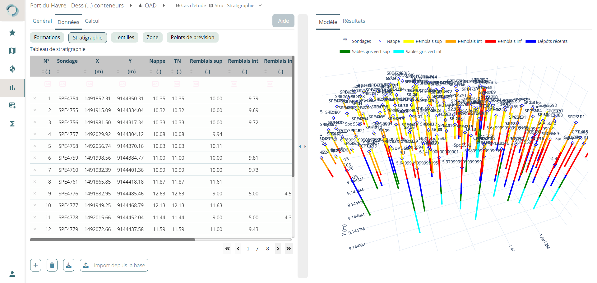
From this data, the STRA module is capable of automatically calculating interpolated interfaces for all soil layers present using the kriging method.
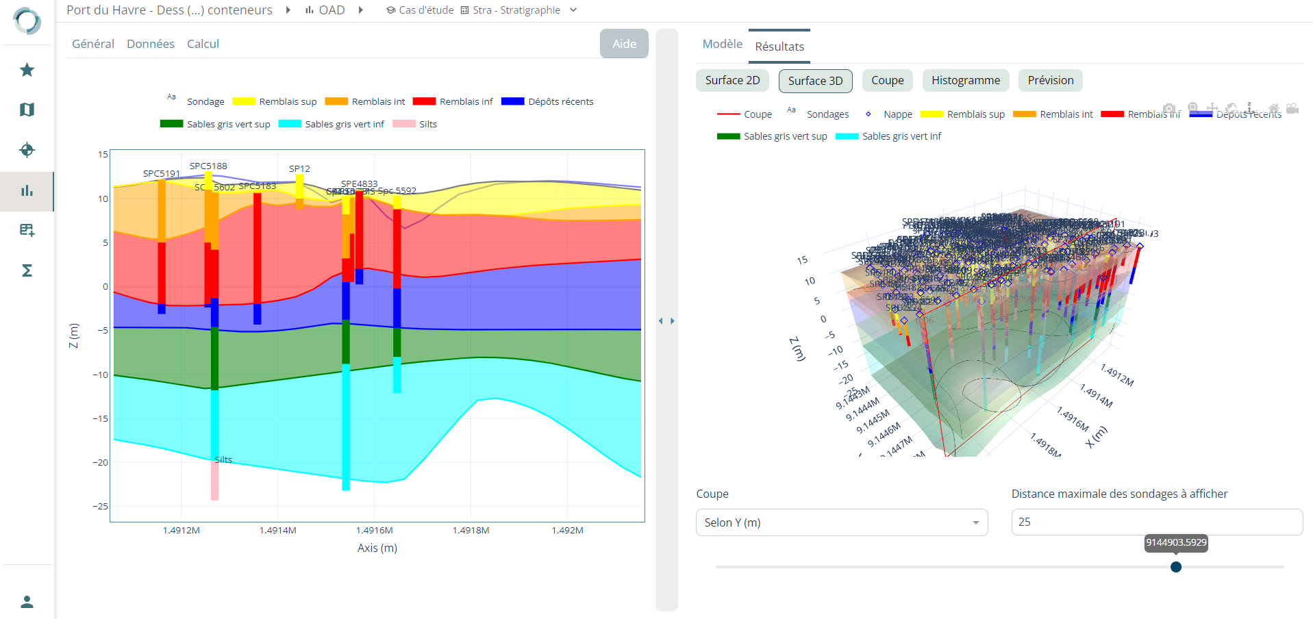
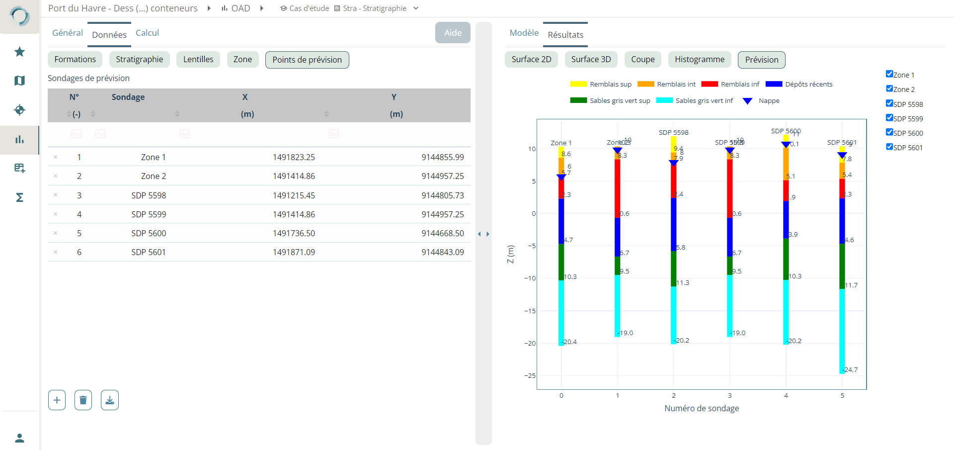
Once the calculation is performed, the STRA module provides you with various results. You can visualize the 2D mapping of each layer and the 3D stratigraphic model. Cross-sectional results are also available. Additionally, the STRA module provides forecast results at the locations of selected (fictional) borehole points you may have pre-selected.
Coming soon
A table containing values at the forecast points will soon be added.