BASE module
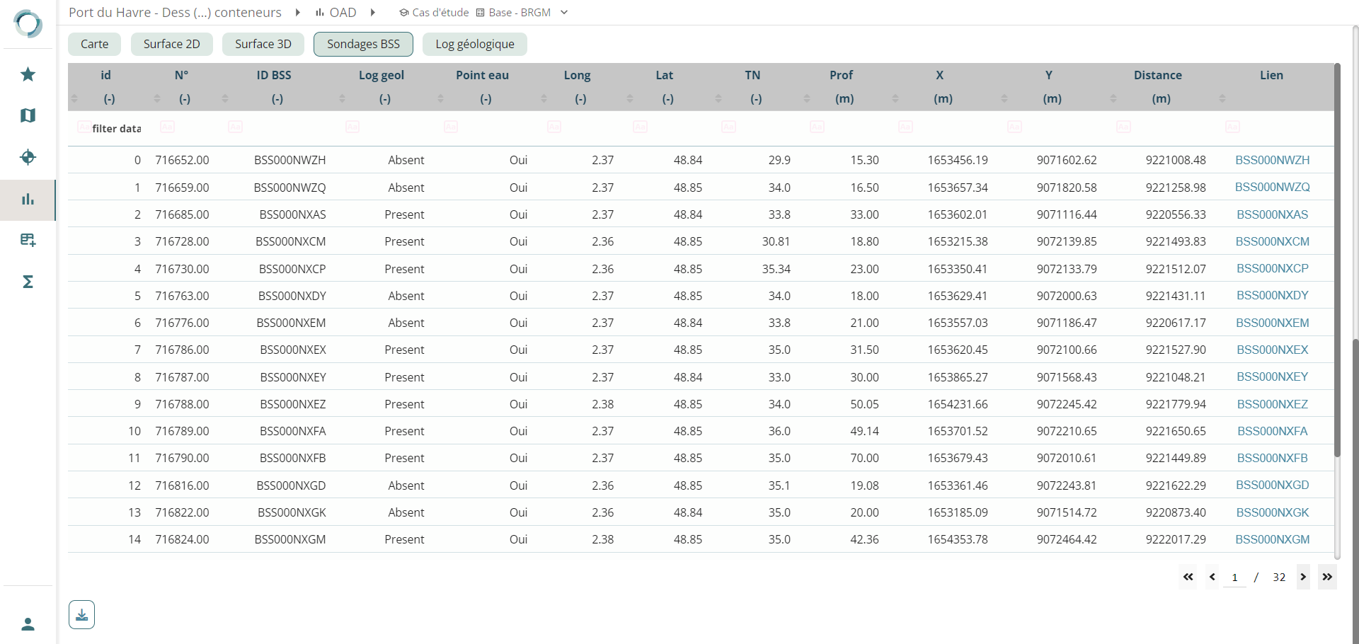
The BASE module provides the ability to display the geological map of France and extract digitized geological information from the Soil Database (BSS).
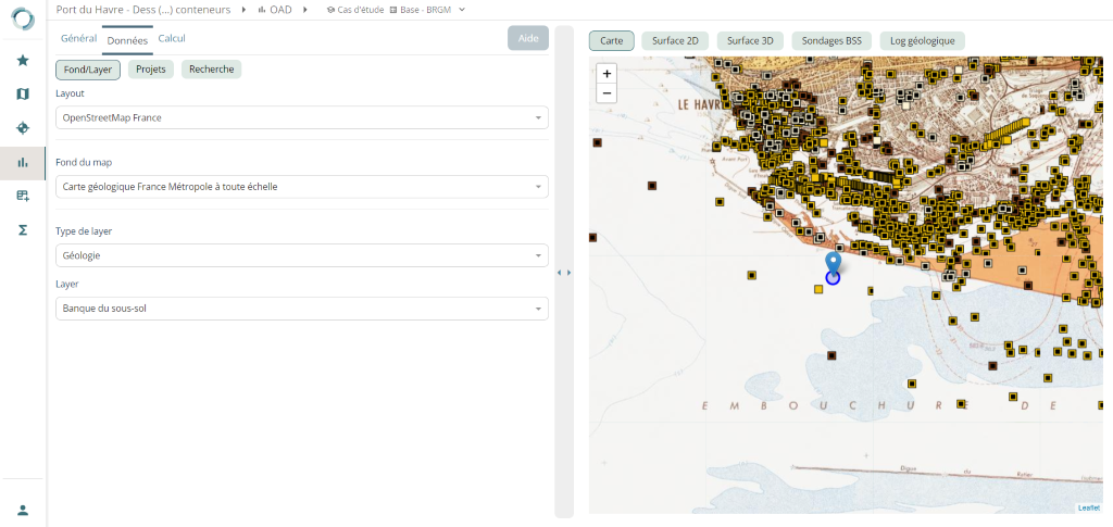
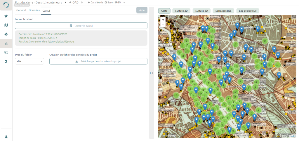
By entering the coordinates of your project (🚧 coordinate import will soon be integrated) and specifying a query radius, the BASE module will conduct a search in the Soil Database (BSS) to retrieve archived geological information. Extracted information includes archived BRGM boreholes and their digitized geological data, if available.
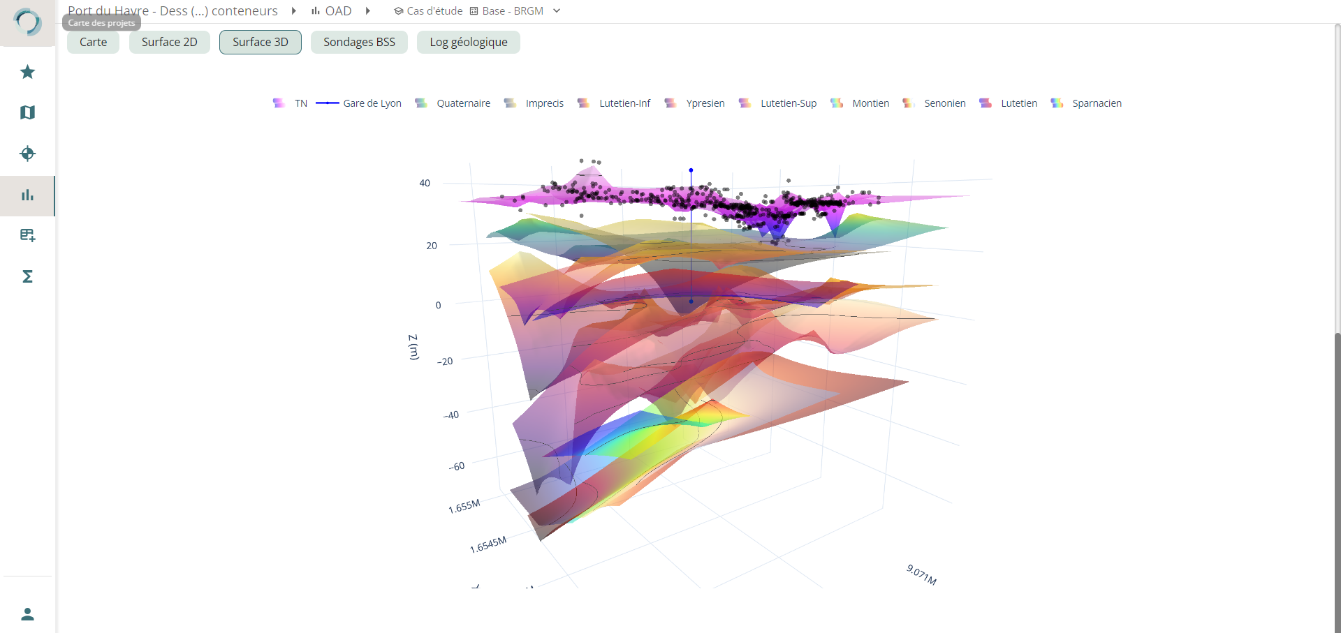
Using the extracted geological information, the BASE module is capable of constructing a 3D geological model. This model provides an initial understanding of the geological context of your study site, offering a visual representation of different geological layers and their spatial arrangement beneath the project site.
Please note that the availability of geological information may vary depending on the region and the quality of data in the Soil Database (BSS).